Return to the Frank Passic
Any photos not otherwise credited are from the personal collection of Frank Passic, Albion Historian.
|
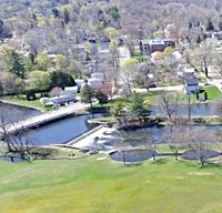
Morning Star, June 24, 2007, Pg. 3 Recently I acquired a book authored by Michigan historian Lee Barnett published in 2004, entitled “A Drive Down Memory Lane: The Named State and Federal Highways of Michigan.” It lists the histories of approximately 250 named state/federal roads in Michigan, both past and present. Albion is mentioned several times, including featured histories of the Dr. Martin Luther King Jr. Business Route, and the Territorial Road. The latter is of particular interest, as Territorial Road was the route upon which thousands of settlers traveled as they populated the state of Michigan, and Albion, in the 1830s. The original name of the route was the Saint Joseph Road. It was surveyed and constructed by using the old St. Joseph Indian trail. The State legislature enacted legislation on November 4, 1829, to carve out the route. The survey was conducted in 1830, and on March 3, 1831, the Territorial Legislature formally declared the road a public highway. Even the Federal government stepped in 1834, and authorized $20,000 for improving the route to accommodate the weight of settler’s wagons, etc. The St. Joseph Road was the main east-west artery in the state of Michigan during the 1830s. Because of its importance and heavy usage, people began referring to it instead as the “Territorial Road,” The name “St. Joseph Road” became outmoded and obsolete. In 1922, the Calhoun County Historical Society named the old Territorial Road between Albion and Battle Creek (now old-U.S-12/Michigan Avenue) as the “Pioneer Trail.” I’ve never heard about nor seen any signs to that effect west of Albion. Ironically, the Territorial Road did not come into Albion. It ran north of town, along what is today C Drive North and Comdon Road. It was Albion pioneer Jesse Crowell who constructed an “exit” east of town, off the Territorial Road into “the Forks,” and an “entrance road” back onto the Territorial Road west of town. That is why Michigan Avenue east of Albion is diagonal up to the point where it meets Comdon Road, as well as Austin Avenue west of town, to the point where it meets C Drive North. East and west of those points Michigan Avenue is the old Territorial Road, but not in and out of Albion. There is a large stone with a plaque stating “Old Territorial Road” that was placed in 1915 near the point where Comdon (Territorial) Road and Michigan Avenue separate. From our Historical Notebook this week we present a photo of that plaque which states, “This Stone Marks the Old Territorial Road. One of two trails over which Immigration came into Michigan. Dedicated to the Pioneers of Calhoun County by Hannah Tracy Grant Chapter D.A.R. 1915.” In an interesting sidelight, the State Highway Department constructed the new bridge on 28 Mile Road/N. Eaton St. over Interstate-94 in 2001. We all remember what happened after a crack was discovered in the main beam shortly after it was erected, but that is another story. After construction was completed, new traffic turn-lane patterns were instituted for those traveling north out of town. Officials apparently used the original legal description when making their signage for the Albion bridge. Signs were placed stating, “Right Lane Must Turn Right at Territorial Road.” C Drive hadn’t been known as Territorial Road since around 1960. At that time road names were standardized in Calhoun County, giving them numerical or alphabetical designations instead of being “named” after something or someone. The new 2002 signs were corrected several weeks later to state “C Drive North.” From our Historical Notebook this week we also present an August, 2002 photograph of the Territorial Road sign upon entering the 28 Mile Road bridge headed north, over I-94. With the price of gas being as high as it is, why not save money this vacation season? You can tour the entire length of Comdon Road/C Drive North from/to the points where they meet Michigan Avenue for less gas than it takes to drive to northern Michigan. Be sure to start east of town by the rock/plaque and head west, just like the pioneers traveled when it was called Territorial Road. Make it a family outing. You’ll have a short detour where I-94 intersects and you’ll have to cross the 27 Mile Road bridge southwards over the highway in order to hook onto C Drive again. 
New Bridge on Territorial Road, C Drive, Eaton Street
All text copyright, 2026 © all rights reserved Frank Passic | Artwork copyright Maggie LaNoue © 2026
| |